
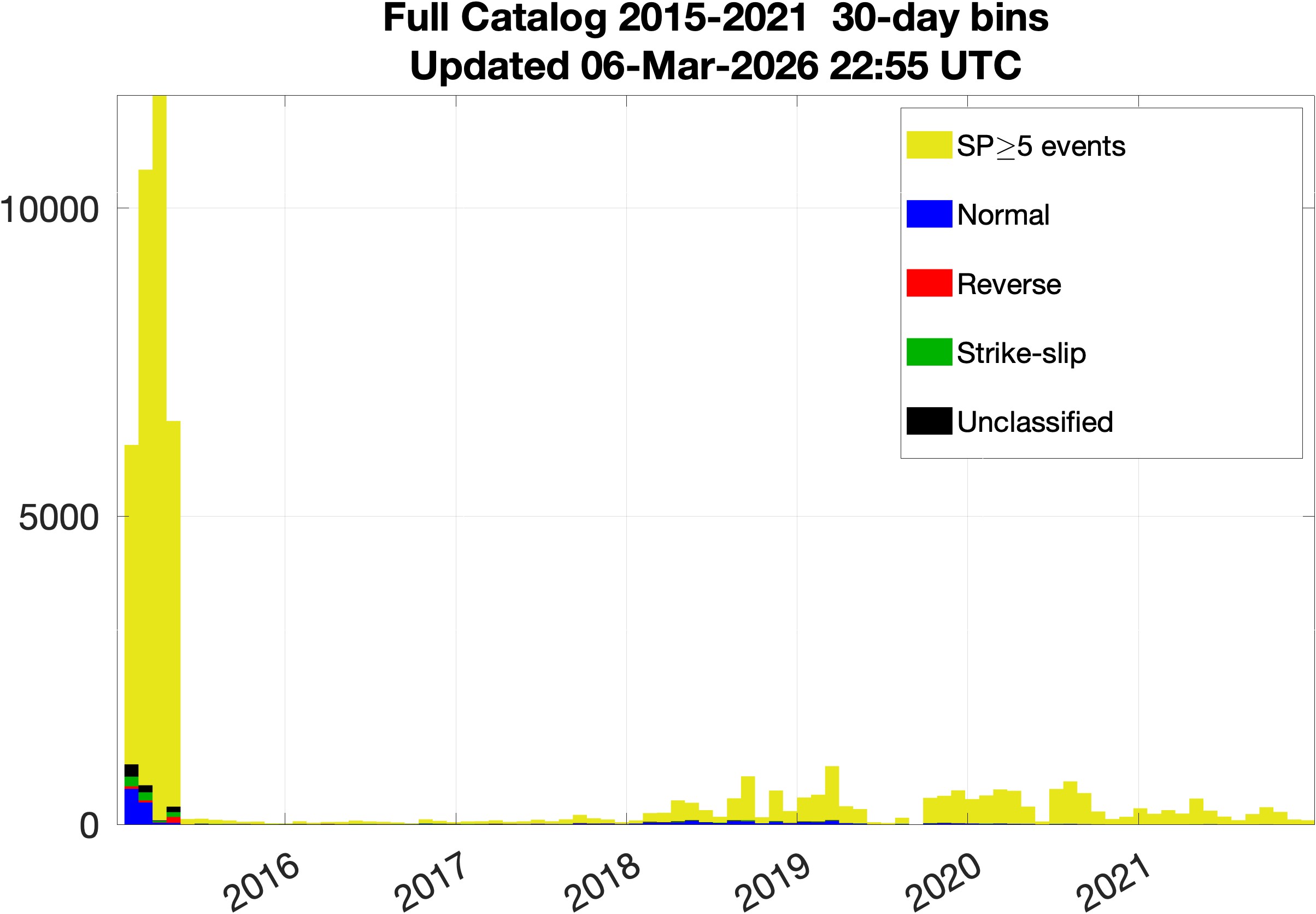
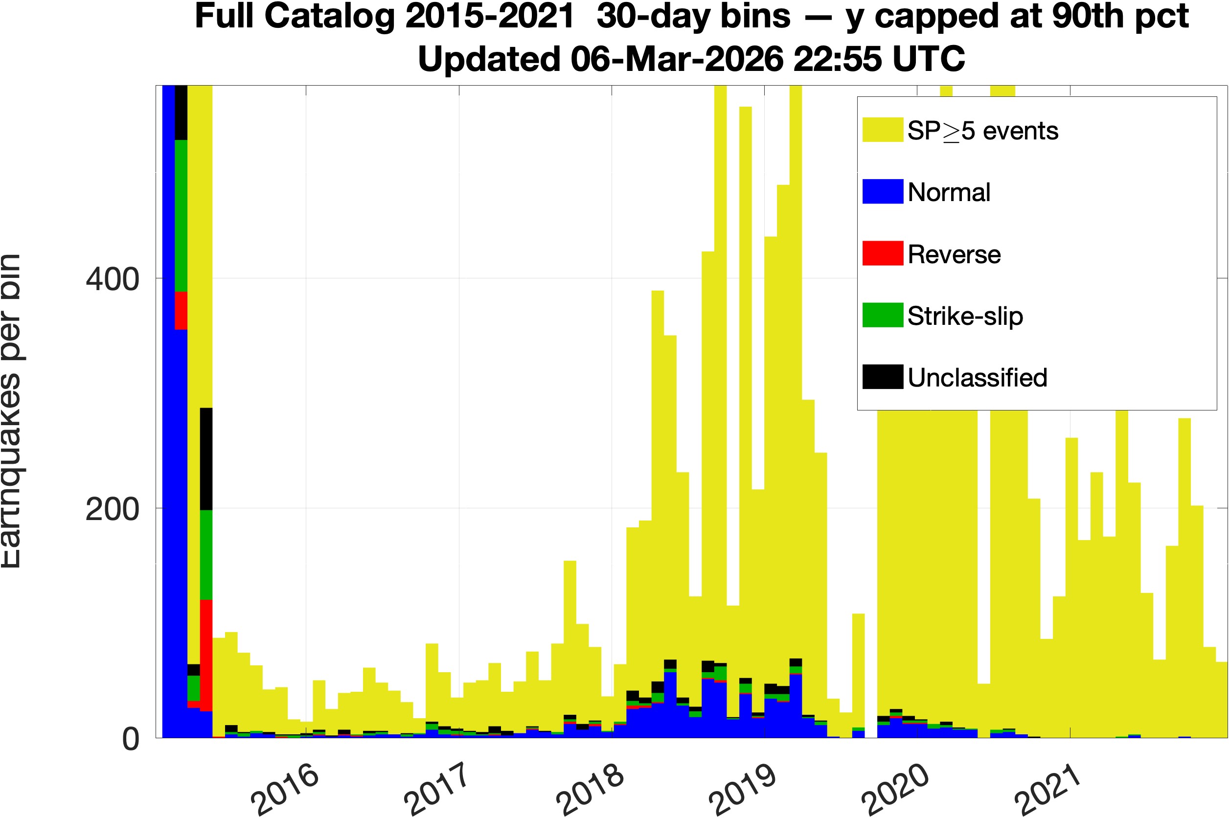
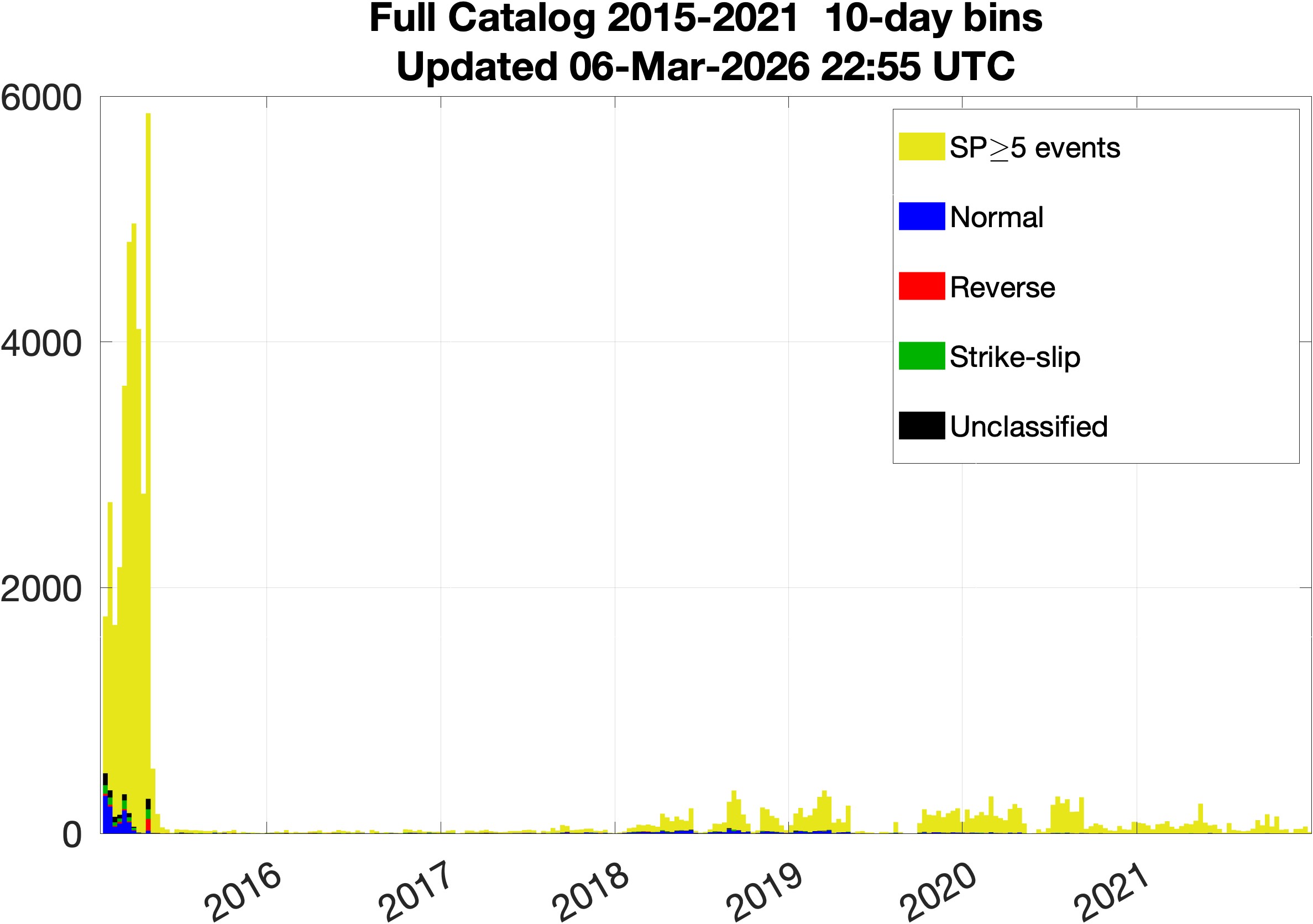
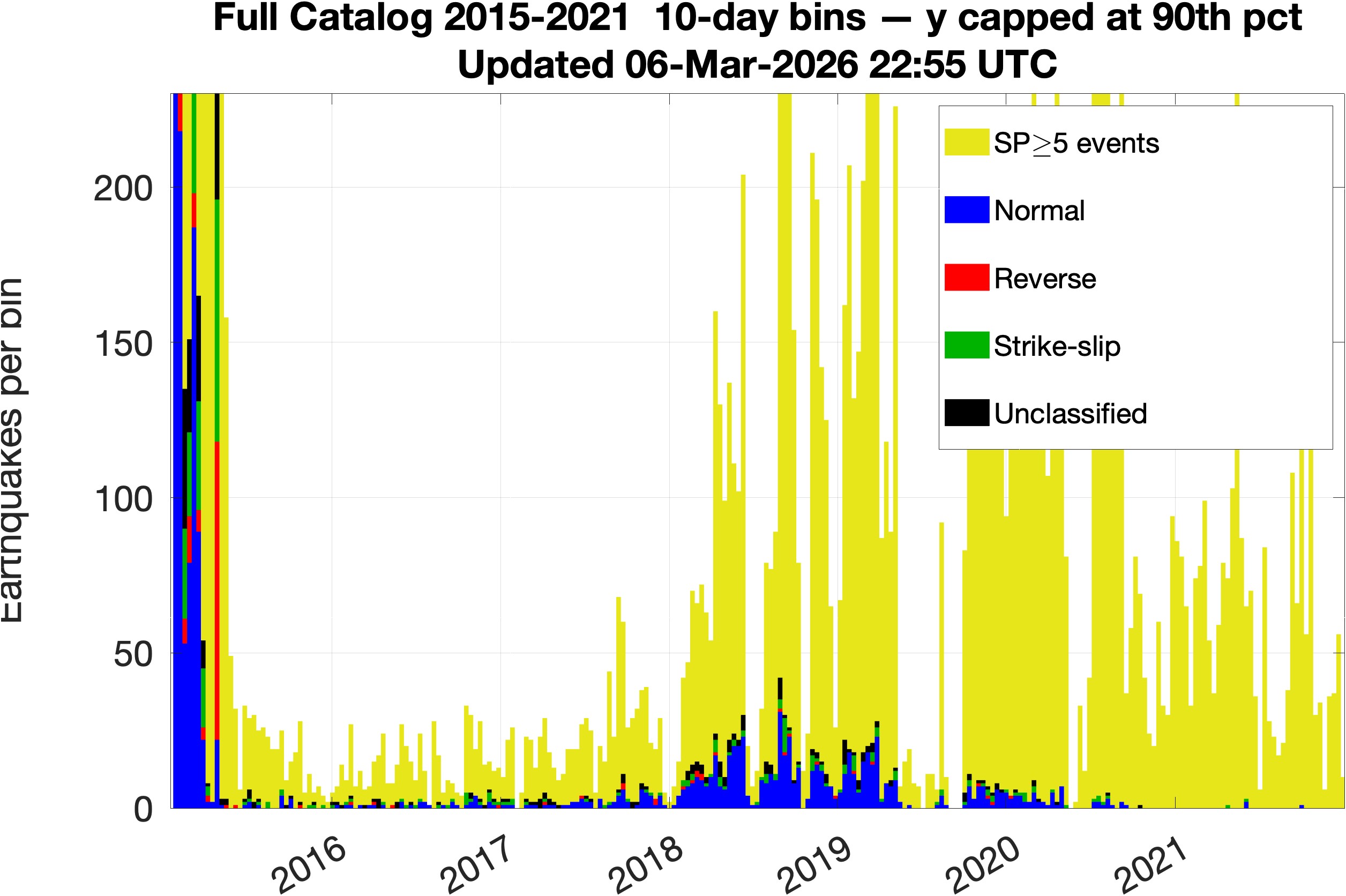
This page provides near-real-time focal mechanism estimates for earthquakes at Axial Seamount recorded by the Ocean Observatories Initiative (OOI) cabled array. For each recent event, the pipeline identifies the 6 most similar historical earthquakes from a base catalog of events with known focal mechanisms. Similarity is measured using a composite distance combining hypocenter location, P-wave first-motion polarities predicted by a deep learning model, and S/P amplitude ratios across seven OOI broadband stations (AS1, AS2, CC1, EC1, EC2, EC3, ID1). Focal mechanisms are inferred by analogy from the matched historical events using the HASH algorithm. Color coding: blue = Normal, red = Reverse, green = Strike-slip, black = Unclassified.
Maps are updated each pipeline run (approximately daily). Last updated: 08-Mar-2026 00:11:18 UTC
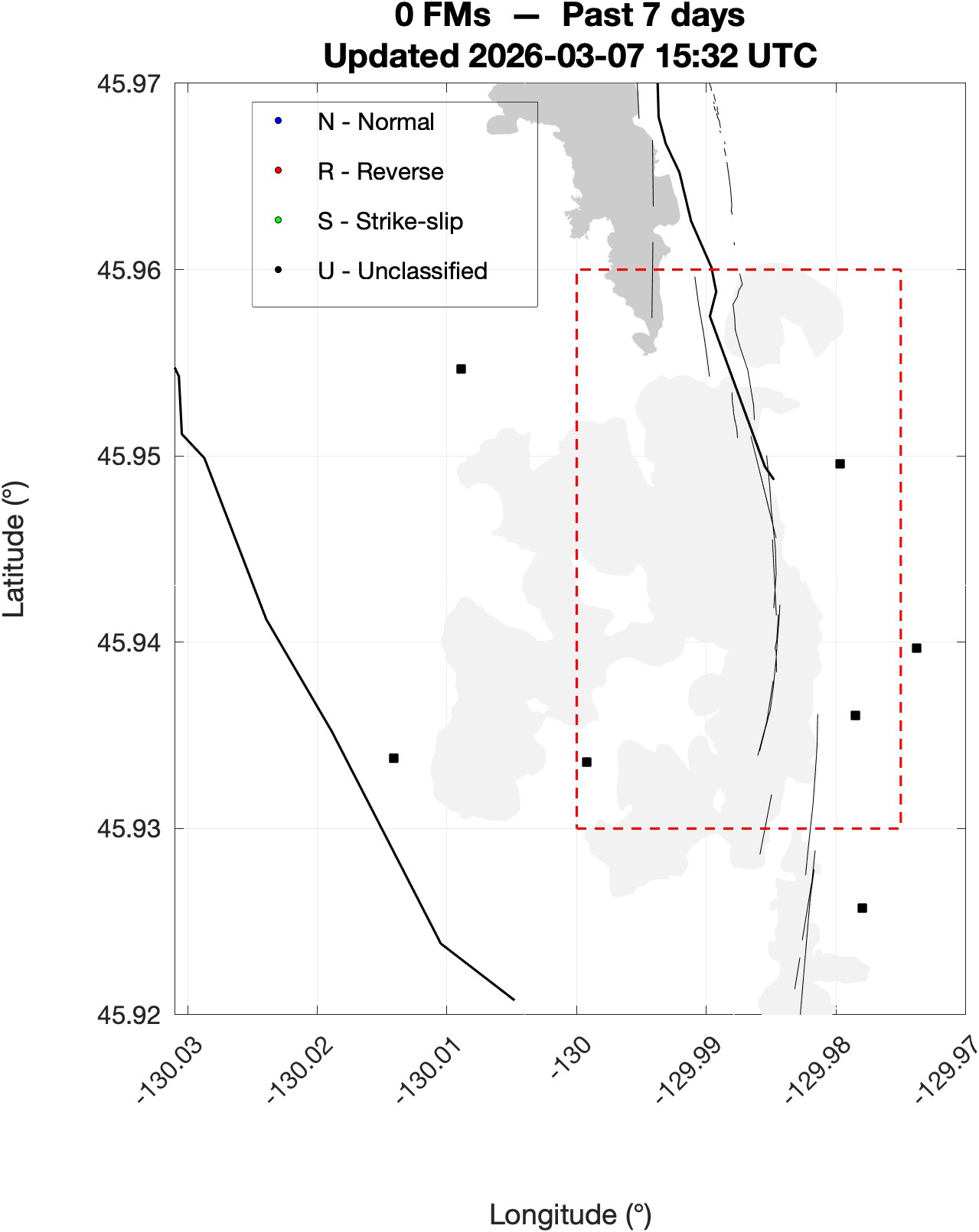
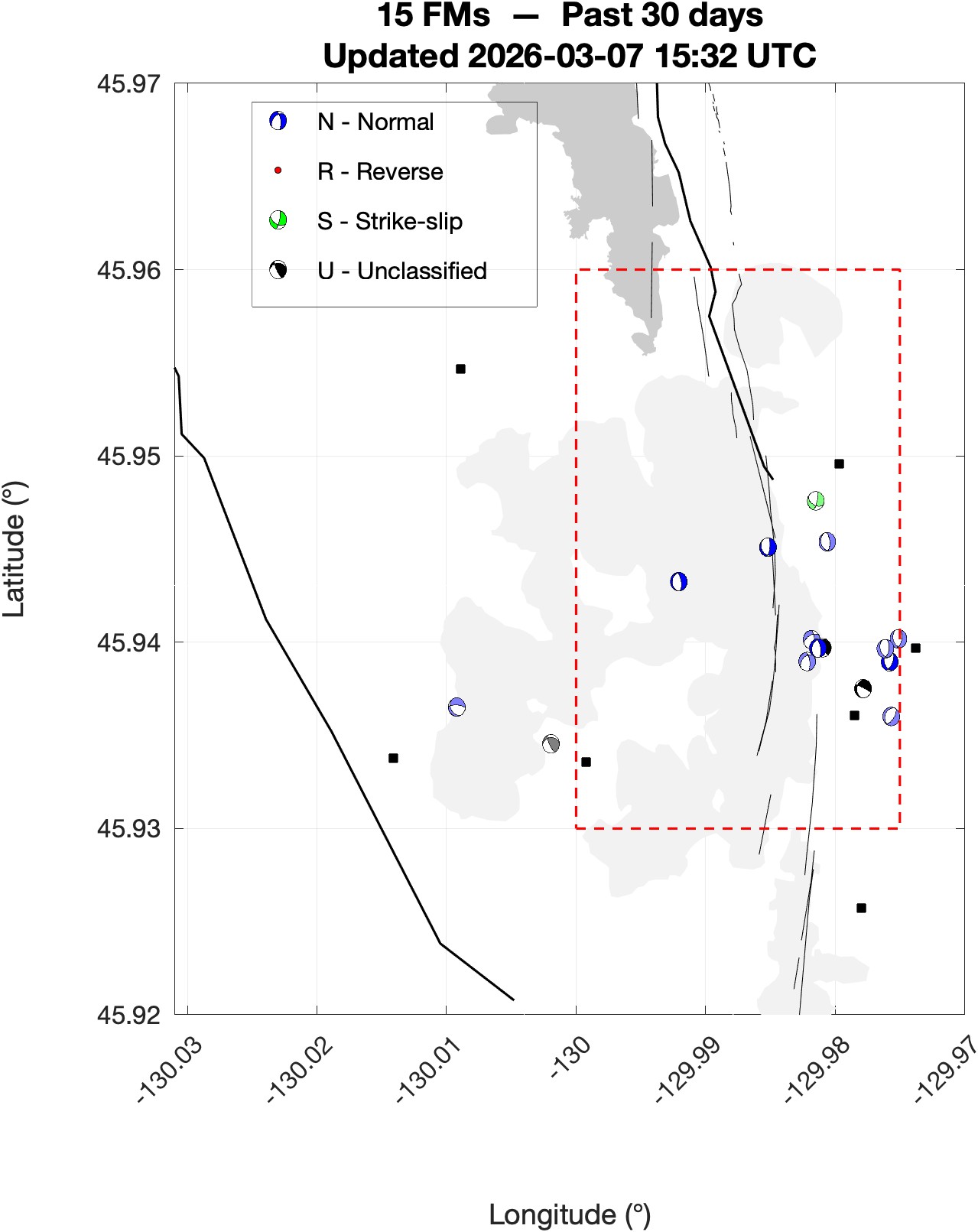
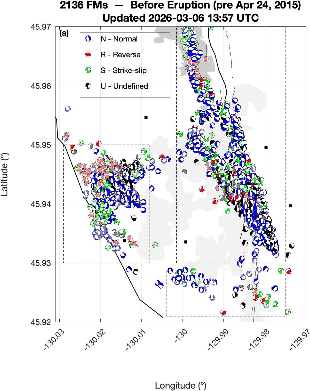
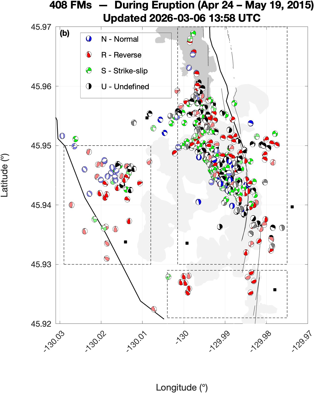
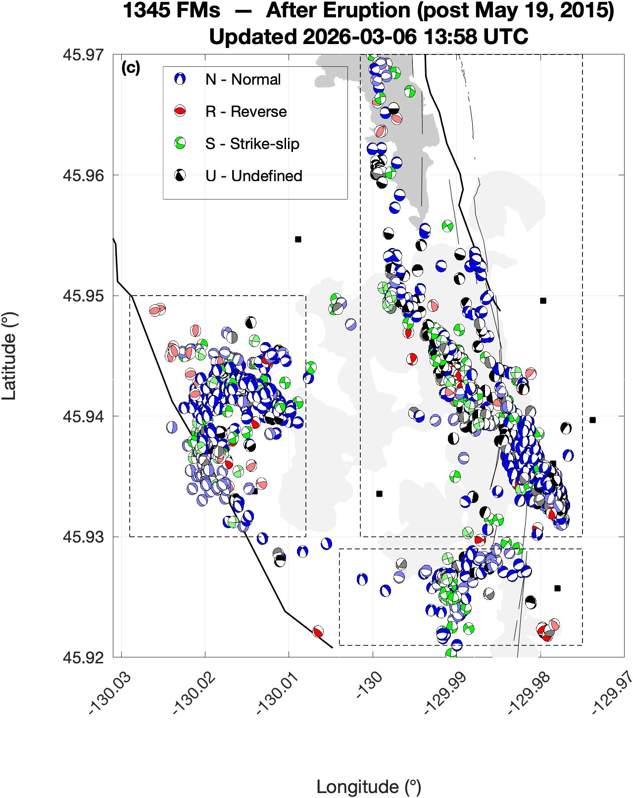
Beach ball size scaled by earthquake magnitude. All monthly maps monthlyFMmap.html
Caldera Focal Mechanisms FMmap.html
Daily hypo71_FM files hypo71_FM.html
Daily ph2dt_po input files ph2dt.html
HYPO71 style catalog — hypo71.dat
Arrival time data in form of input catalog for ph2dt algorithm of HYPODD — ph2dtInputCatalog.dat